|
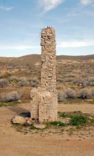 |
| A
lone chimney stands in the Summit Diggings area. The
structure is mentioned in Strong's 1970 Desert
Magazine story. |
The Summit
Diggings placer mining area straddles Kern and San
Bernardino counties north and west of Randsburg and
Johannesburg. The name is derived from the proximity to the
summit of a pass around the El Paso Mountains traversed
today by Highway 395. The Diggings was one of a small group
of dry washing camps including Goler, Garlock, Red Rock
Canyon and Last Chance Canyon.
 |
|
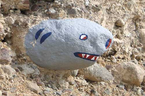
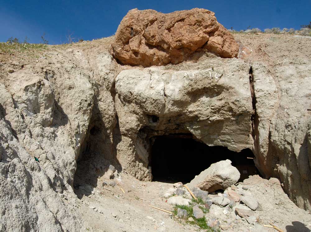
A
dugout, also mentioned in Strong's story, looks
vaguely reptilian from the outside. |
The
diggings was never very large or particularly productive. Its primary claims to fame are as a starting point for the
three prospectors who eventually located the Yellow Aster
Mine (Burcham, Mooers and Singleton) in 1895 and as the site
for a tunnel built in 1908-1909 by the Southern Pacific
Railroad's Jawbone Division that once connected Mojave
with the Owens Valley. The original tunnel, at 4,340 feet,
was one of the longest on any SP line at that time.
Mary Frances Strong wrote in
Desert
Magazine
(November, 1970), “The Summit Diggings is an interesting
desert locale to visit. They lie in an extremely arid region
which can be blistering hot in summer; while, in the
midwinter months, icy winds may roar across the land with
gale-like force.
Conditions
were hard at the Summit. It was a haphazard camp of tents
and primitive dugouts. The enterprising shopkeepers of the
time didn’t feel it was even worthy of one store. Supplies
had to be hauled in on wagons from the other camps resulting
in sky-high prices on all items."
According
to a 1925 report from the California State Mining Bureau,
only two commercial placer mining operations were were the
gravels- the Oro Fino Mining Co. and the Summit Placer Gold
and Rock Co.
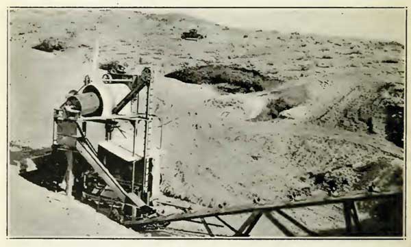 |
| A
Stebbins dry concentrator on the property of the Oro
Fino Mining Company (1925). |
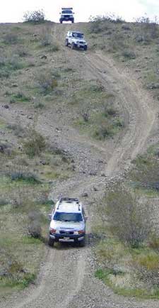
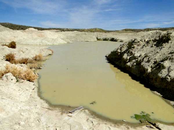
Today,
weekend and recreational miners can be seen shifting the
Summit's sands in hope of finding color. The Gold
Prospectors Association of America (GPAA) has a large claim
in the area called "Duisenburg" located a short distance
north of Highway 395 just west of the railroad tracks. The
area is also popular with OHV green sticker
enthusiasts and 4 x 4 backcountry explorers such as
ourselves.
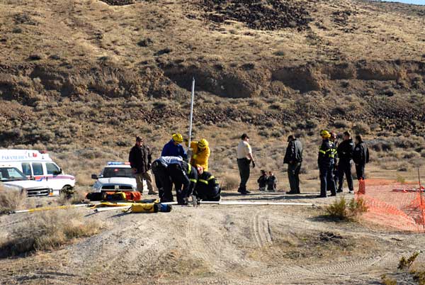
One
unlucky motorcyclist slipped and fell down an old mine shaft
in November, 2010 and had to be extracted by rescuers from the BLM and Kern and San Bernardino counties (see EHC,
December 2010).
 |
 |
|
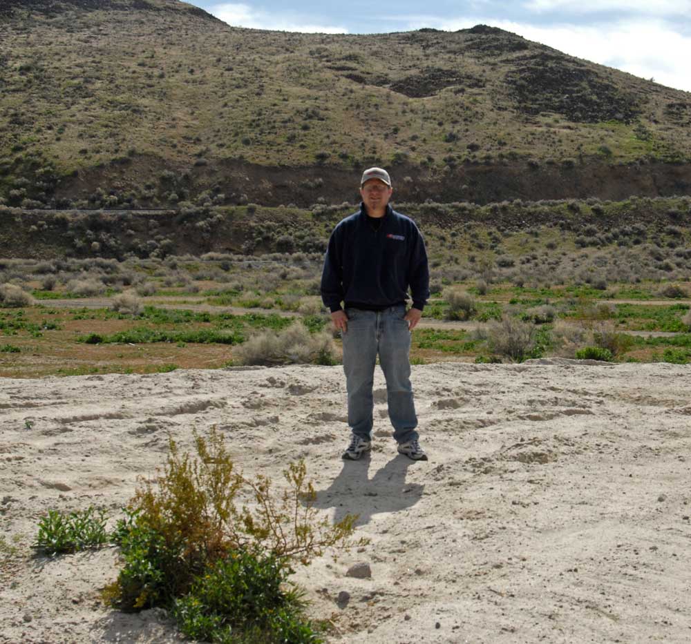
Rescuers work to lift a motorcyclist out of an
Summit Diggings mine shaft in November, 2010 (left).
Eric Vargo poses over the filled in hole, March,
2011 (right). |
Trains
Construction of the Los Angeles Aqueduct (1908-1913) was a
major project in terms of cost ($24.5 million), workers
(more than 4000), scope (Owens Valley to Los Angeles) and
logistics (moving workers, equipment and supplies to where
they were needed).
The system
of roads in the area where the aqueduct was to
be constructed was, at best, primitive. The only practical
long distance transportation solution was rail travel.
Southern
Pacific rails reached Mojave in 1876 and were extended into
Los Angeles by the following year. The SP also had a rail
line, the former Carson and Colorado RR, that served Owens
Valley and western Nevada. However, the systems didn't
interconnect and there was a long stretch of land from
Mojave north to Lone Pine that was unserved by any railroad.
That very area was to be the route of the new aqueduct.
|
 |
|
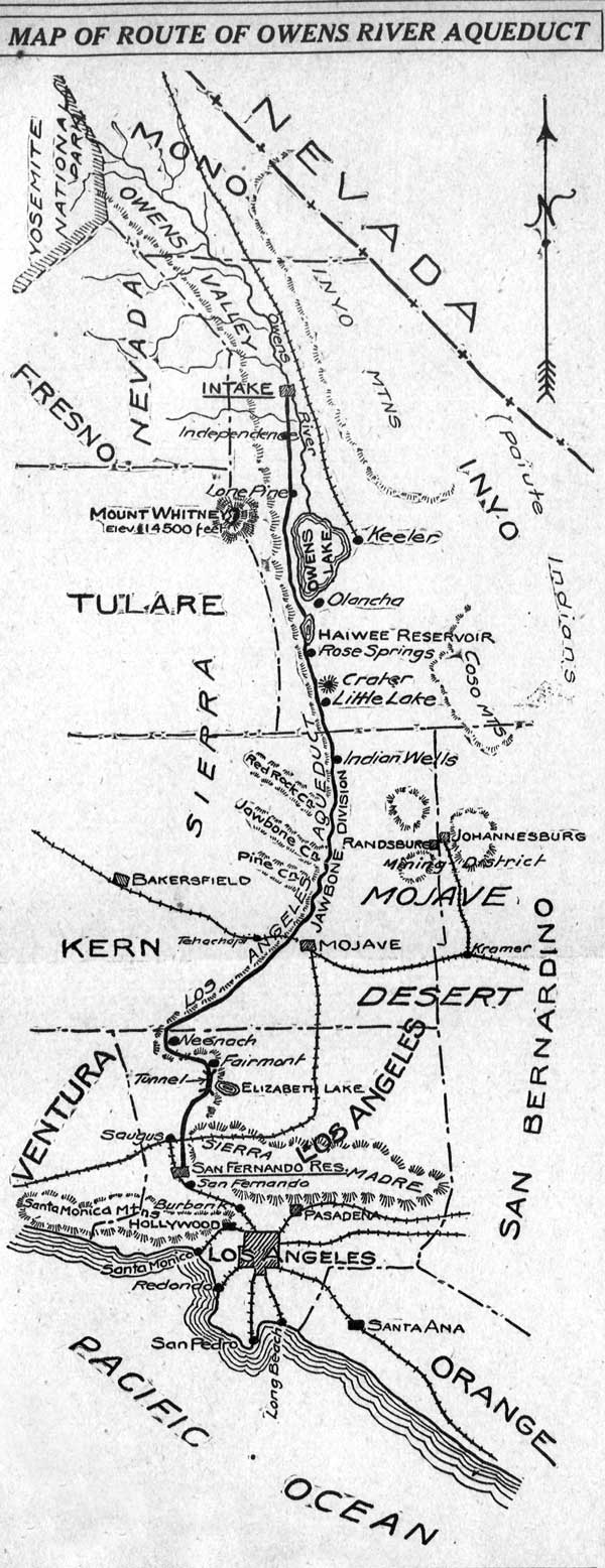
The Los Angeles Herald published a map
showing the route of the Owens River Aqueduct, April
13, 1908. |
An article
in the San Francisco Call of August 9, 1906 headlined
"Los Angeles Asks the Southern Pacific to Construct Line
Across the Desert. J. B. Lippincott, supervising engineer of
the Owens River project...will leave Los Angeles the last of
the week for the Owens River country. The object of the
journey is to make a survey for a railroad which will be
built from Mojave, eighty miles northward, across the Mojave
desert and through Red Rock canyon. It is to be used in the
construction of the Owens river conduit...The
Southern Pacific Railroad Company has been asked to
construct and operate the road."
Construction on the Jawbone Division, as it was called,
began in 1908. The route through Red Rock Canyon, although
shorter by mileage, was avoided because of steep grades and
concerns about washouts from flash flooding. A
temporary nine mile spur line was built from Cantil to Dove
Springs that supplied the construction needs of that section of the
aqueduct project. It operated for 22 months and was
dismantled for scrap in December, 1910.
The Los
Angeles Herald reported April 17, 1908, "In the
Mojave desert, between Mojave and Jawbone canyon, the
Southern Pacific will soon be rushing the work of
constructing twenty-three miles of track. This will be
commenced as soon as the contract is signed. Sixty days is
allotted for this work, and the Los Angeles aqueduct
commission is anxious to begin hauling material for
constructing the tunnels at Jawbone. Material is being
gathered for the first section of the Owens Valley branch,
while one mile of the track at Mojave has been graded. The
aqueduct engineers want the material started soon, as it
will take many months to bore the tunnels, the natural lay
of the land presenting many difficulties."
Formal aqueduct
construction began September 8, 1908
according to the LA Herald in a page 12 story, "With the immense amount of preparatory work about completed,
actual construction of the big aqueduct that will bring the
Owens river water to Los Angeles will be started today."
The Red
Rock detour added some 18 miles of trackage and required the
railroad to turn east at Cantil and parallel the El Paso
Mountains, turning north at Garlock and again west through
the Searles Summit pass area and Rademacher Gap. Then the
tracks finally
head northward into the Owens Valley and terminate north
of Lone Pine at Owenyo where it met the narrow gauge tracks
of the old Slim Princess. The line was dedicated October 18,
1910 at a ceremony in Owenyo.
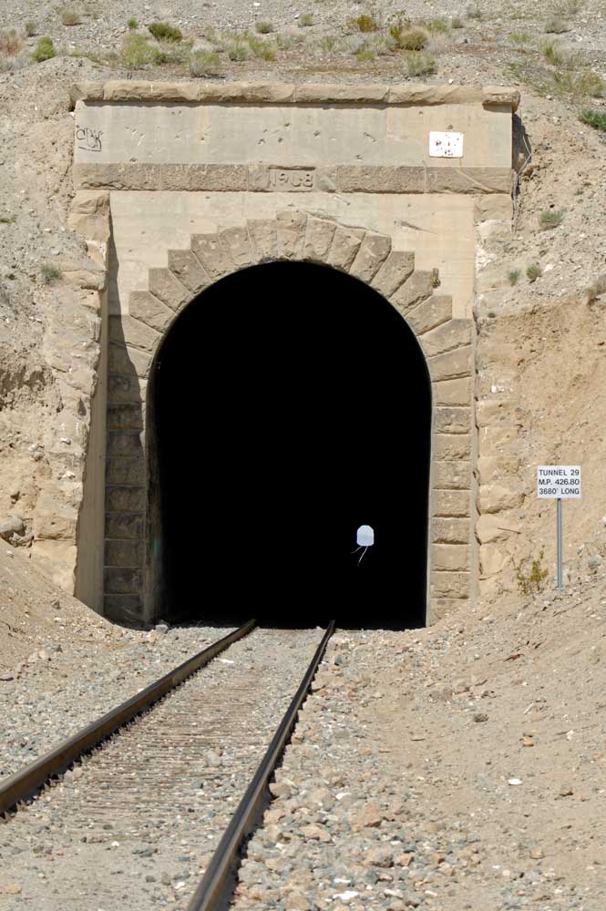
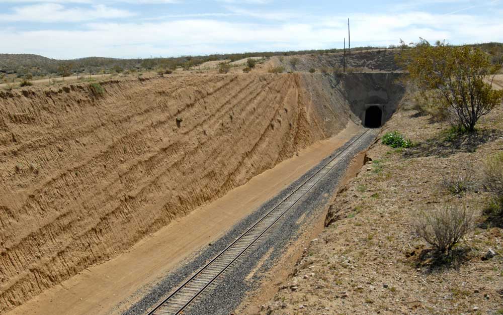
The
Searles Summit pass presented an inefficient (steep) grade
for the locomotives so a tunnel was constructed 4,340 feet
under the pass. Work started in 1908 and was
completed late in 1909. While the tunnel was being built, a
temporary bypass called a "shoo-fly" was graded to allow
rail traffic to continue through. The temporary tracks were
abandoned after the tunnel, then known as Tunnel 29, was
completed.
|
 |
|
 |
 |
|
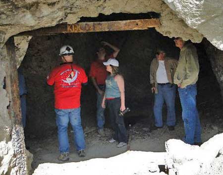
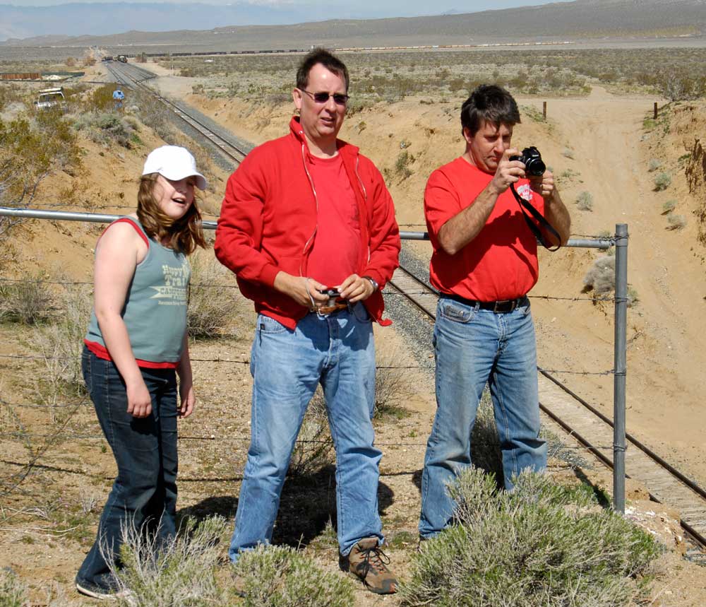
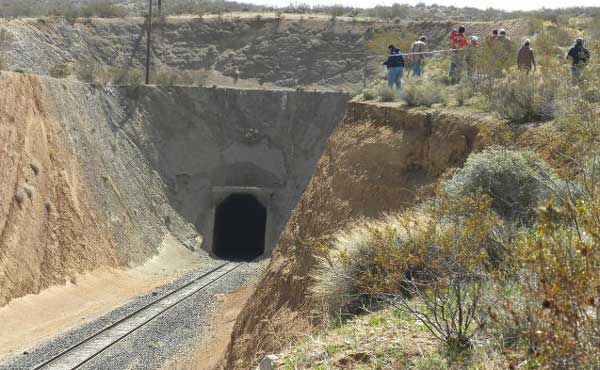
The
east end of Tunnel 29 still has the original date
(1908) above the portal (top).
Emily Gardner (see "A
Trip to Summit Diggings" below), Kevin Fitzgerald
and Tim Gardner inspect the west end of the tunnel
(above). |
|
 |
|
Some
of the original parts of the west end of Tunnel 29
(above) were removed and the tunnel shortened during
repairs after the 1981 fire. The original tunnel was
one of the longest on the Southern Pacific. |
The old
shoo-fly remained graded, but dormant, for 72 years until a
fire of suspicious origin closed Tunnel 29 on February 22,
1981.
While
trucks had gradually replaced the SP freight service from
Mojave to Lone Pine, the rails were still used by a lumber
operation near Pearsonville and the Trona Railway. The old
shoo-fly, which was in remarkably good condition, was
retracked and restored to temporary use by March 19, 1981.
The temporary route was used for more than a year
while the Searles Tunnel was repaired. The tunnel was
reopened July 27, 1982.
The
Southern Pacific officially abandoned its Jawbone branch north
of Searles station August 22, 1982, bringing an unceremonious
end to railroading in the Owens Valley. The Trona Railroad
still operates over the tracks from Trona to Mojave,
including old Tunnel 29.
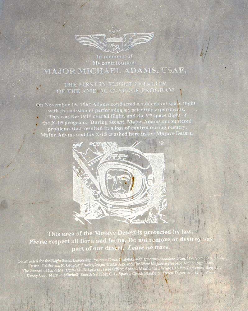
Crashes
The loss
of astronauts' lives in the Apollo 1 (January 27, 1967),
Challenger (January 28, 1986) and Columbia (February 1,
2003) disasters are sadly remembered by many. Unremembered
by most is USAF Major Michael J. Adams,
America's 27th astronaut, who died November 15, 1967.
Adams was at the
controls of an X-15 that went out of control and crashed
north of the Summit Diggings after reaching an altitude of
266,000 feet. His crash marked the end of the X-15 program.
|
 |
|
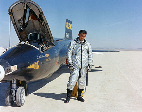
Michael Adams poses beside the number one X-15
following a successful research flight on March 22,
1967. Adams perished in the crash of the number
three ship on Nov. 15, 1967.
(NASA Photo) |
Adams
fight began when his X-15 (66672) was dropped from its B-52 mothership at 45,000
feet over Delamar Dry Lake (Nevada) at 10:30
a.m. A sensor shut down the aircraft's engine after launch,
but Adams was able to restart it 16 seconds later. As the
rocket plane climbed through 85,000 feet, an electrical
disturbance momentarily distracted Adams. The aircraft
reached its maximum altitude of 266,000 feet at 10:33 and
was off its planned heading by 15 degrees. The plane began
descending at right angles to its flight path and entered a
Mach 5 spin at 10:34 at 230,000 feet elevation.
Adams
radioed "I'm in a spin, Pete." (referring to controller and
fellow pilot Pete Knight). He was able to recover from the
spin at 118,000 feet but went into an inverted dive at Mach
4.7. The ill fated aircraft began to pitch as it crossed
over Cuddeback Lake. Adams was subject to more than 15 g of
vertical force and 8 g laterally as his plane dove at
160,000 feet per minute. The X-15 disintegrated into many
pieces, killing Adams and hitting the ground north of
Johannesburg.
 |
 |
|
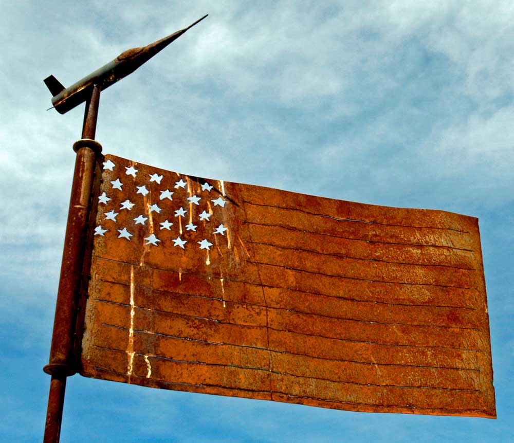
The
Memorial to Major Michael J. Adams, Sr. was
dedicated May, 2004. It is located in a remote
desert area north of Johannesburg, Calif. near the
Trona Rd. |
|
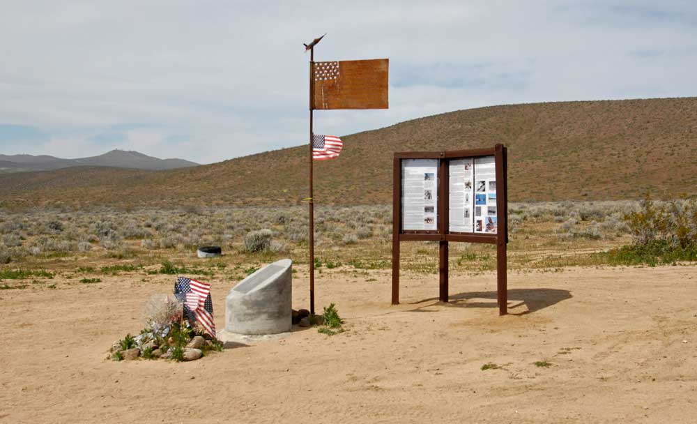 |
John
Bodylski of Boy Scout Troop 323 in Tustin, Calif. and
aerospace historian Greg Frazier led an effort built a
memorial to Adams as Bodylski's Eagle Scout project. The
memorial was built near the crash site and was dedicated May
8, 2004. Approximately 60 people attended the ceremony,
including members of Adams' family