In
the winter of 1776, early California governor, Felipe Neve, and a
small band of soldiers trekked north from Baja to Monterey. By
February 3, 1776 they reached their Alta California destination and
proclaimed Monterey the provincial capitol. Nine months later, the
first civilians settled in San Jose. Inspector General Teoedoro de
Croix proclaimed that a second pueblo was to be established. The
instructions sent to Governor Neve announced: “I have ordered the
founding with the title de La Reina de Los Angeles sobre el rio
de la Porciuncula.” Pobladores (settlers) were recruited to form
the new pueblo.
 |
|
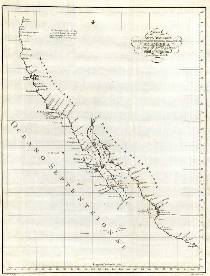
1802
Spanish/Mexican map showing the California coastline
as of 1791 (Carta Esferica de los Reconocimientos
Hechos en la Costa N.O. De America en 1791 y 92 por
las Goletas Sutil y Mexicana, y otros Buques de S.M.
Cardano lo grabo. Morata lo escribio. Numero 1.
)
Map
courtesy David Rumsey Historical Map Collection |
Eleven
settlers and their families from Sinaloa and Sonora, Mexico,
thought the journey worth while. Their number totaled 44.
Two heads of the family were pure blooded white Spaniards,
four were Indians, two were Negro, two Mulatto, and one was
Mestizo. Twenty-six of the settlers reportedly had African
blood running through their veins. Twenty-two of them were
children. Most of the group were poor farmers looking for
something newer and better.
Soldiers
escorted the pobladores from Los Alamos east of Loreto on
the Mexican mainland. The year was 1781, and everyone had
been promised seed and animals for the journey. Captain
Rivera who had led a mission finding expedition in 1769 was
their leader.
Travel
was by sea and land to the banks of the Porciuncula River
that Father Crespi had described in a 1769 diary as “a very
spacious valley, well grown with cottonwoods and sycamores,
among which ran a beautiful river.” The area today is known
as the North Broadway entrance to the Elysian Park near the
Los Angeles River. The River had been dubbed by Crespi “el
rio de Nuestra Senora de Los Angeles de la Porciuncula”
in honor of a Franciscan celebration observed in August
first known as the “Jubilee of Our Lady of the Angels of
Porciuncula”
It was
seven months or so before the original settlers started
arriving at Mission San Gabriel. Plans for the new pueblo
were drawn up on September 4, 1781, by Governor Neve. The
date stamped on official records sent to Spain, became the
official birthday of the city of Los Angeles, and is still
celebrated with recreations of the original trek of the
founding families.
 |
|
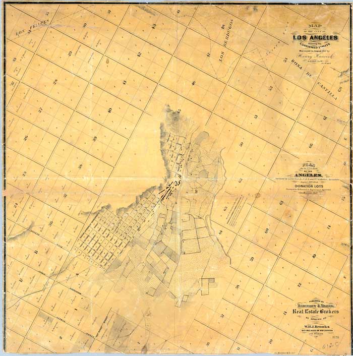
1857
map of the City of Los Angeles by Bancroft & Thayer;
Hancock, Henry; Hansen, George; Ord, E.O.C.
Map
courtesy David Rumsey Historical Map Collection
|
The
original families were each given plots and a lot that faced
the Plaza, which was the community center for over a
century. Struggling villages took three years to build a
small adobe church. Corporal Vincent Feli, a Spaniard in
command of an army of four or five Mexicans was in charge of
the government. By 1800, seventy families lived in 30 adobe
dwellings and survived by raising grain and cattle.
The
pueblo was described as ugly with crooked and ungraded
streets. Caballaros kicked up clouds of dust as they
galloped through the streets. Sidewalks and shade trees were
non-existent. The adobe houses the families lived in were
described as mere hovels with flat roofs covered with
brea (asphatum or tar) from the springs west of town.
Tiny fields imperfectly cultivated supported a few roots and
vegetables for the families. Treks to the San Gabriel
Mission were made weekly for other supplies. Water came from
ditches controlled by the most important public official,
the zanjero, who kept them free of animals and
laundry, and made sure the water was directed into proper
tributary channels.
After the
first decade of life El Pueblo soared to a population of 139
with a successful agricultural community. A chapel had been
built, and three soldiers received grazing permits. In 1815,
however, torrential rains flooded out the pueblo, forcing
relocation on higher ground. The Plaza Catholic Church of
1822 and the Avila Adobe of 1818, located on present day
Olvera Street, are the only surviving structures from the
Spanish period of the pueblo.
Early Los
Angeles was a Spanish-Mexican settlement, controlled by
Spain, and colonized by Mexico. Outside contact with the
rest of the world was restricted to two ships a year.
Following secularization of the missions (1834-1837) more
American traders, miners and adventurers trickled in,
embracing the Roman Catholic church, marrying Mexican
heiresses and becoming Yankee Dons throughout California.
The names of Mexican cattle barons (Pico, Figueroa,
Sepulveda, Bandini, and others) are commemorated in street
and place names in modern times.
Following
the Mexican war and the eventual seizure of California by
the United States the period between the 1850’s and 60’s was
tumultuous with horse and cattle thieves, desperados raiding
stagecoaches and freight wagons, murdering bad men,
professional gamblers, escaped criminals and fugitives from
justice.
One book
describes the influx of newcomers as “offscourings of hard
bitten communities below the border and backwashed from the
mines, ruffians of every sort whom vigilance committees in
the north had encouraged to migrate to other fields.” As a
major point of civilization in Southern California, Los
Angeles would be come a rip-roaring frontier town.
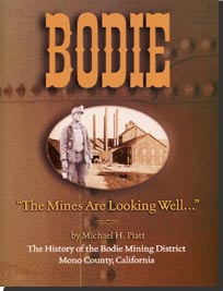
Nearly a
century and a half after the violent period, author Gordon
De Marco would write: “The legendary mining town of Bodie,
located on the east slope of the Sierras, had the reputation
as the rootin’tootin’, shootin’est town in the old west. A
town that was too tough to die and too mean to live. A place
where Clint Eastwood would have needed a bodyguard.
‘Goodbye, God, I’m goin’ to Bodie’ is what men who pulled up
stakes and went to work in the mines there used to say.
There was no correspondingly catchy phrase for Los Angeles,
which by most accounts was a far rougher place. Had there
been one it might have been, ‘Hello, Hell, I’m here in Los
Angeles.’ In reality, during the time period of 1848-1871
the sleepy pueblo struggling to turn town was often referred
to as Los Diablos or the devil.
 |
|
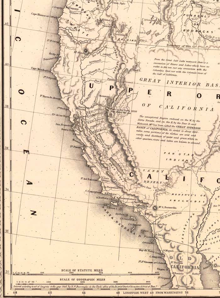
1848
map of Oregon, Upper California and New Mexico by
Bourquin, Frederick; Mitchell, Samuel Augustus;
Tanner, Henry S.
Map
courtesy David Rumsey Historical Map Collection |
To be Continued…..
Bibliography
A Short History of Los
Angeles
by Gordon DeMarco
Lexikos 1988
California: American
Guide Series
by Works Progress
Administration
Mabel R. Gillis California
State 1939
The Cattle On A Thousand
Hills-Southern California 1850-1880
by Robert Glass Cleland
The Huntington Library 1941
History of Los Angeles
County California 1880
by Thompson & West, Reprinted
by:
Howell-North 1959
Maps courtesy David Rumsey
Historical Map Collection
www.davidrumsey.com